View from birdwatching hide over wetland habitat - Mark Hamblin/2020VISION
Natural Capital Assessment Partnership (NCAP)
Natural Capital Assessment Partnership
Formerly known as the Habitat Biodiversity Audit, the Natural Capital Assessment Partnership (NCAP) was established back in 1995 and is still going strong today.
Providing over 25 years of habitats data, NCAP is a world leading project that over the years has been endorsed as ‘ground-breaking’ by a range of external organisations. It has featured in numerous publications, heralded as the ‘standard to follow’.
Managed by Warwickshire Wildlife Trust, the project is predominantly funded by local authorities across Warwickshire, Coventry and Solihull. It also benefits from being hosted by Warwickshire County Council, which allows the team access to other datasets and expertise that complement our own.
Our remit

By April Webb - The team meet lots of wildlife on survey like this thick-legged flower beetle
Habitat mapping
Given the challenges faced by wildlife, understanding the underlying habitats data is essential. It allows us to track which habitats we are losing or gaining over time, or to see where we can better join up habitats and provide corridors for wildlife to move through the landscape.
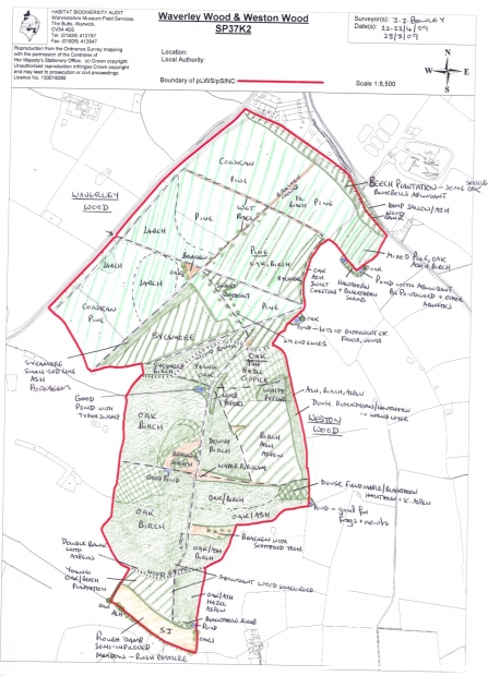
Since the partnership began, the NCAP team have been gathering habitats data on the ground using a survey method known as ‘Phase 1 surveying’. Habitats have been re-surveyed on a rolling basis, providing a continuous revision of the habitat map for the region.
The habitat mapping data is important as it underpins strategic decision making for all the partners involved in the project. It has been used for academic research and wildlife projects, as well as for informing local planning decisions. Warwickshire Wildlife Trust identified its priority Living Landscape areas using NCAP data. Each of the local authorities that provides financial support for the project uses the information produced to make decisions on where to locate new housing and industry developments.
Local Wildlife Sites
Local Wildlife Sites (LWS) are non-statutory wildlife-rich areas. They can be privately or publicly owned and include a wide range of wildlife habitats. These include ancient woodlands, wetland meadows, species rich hedgerows, wildlife ponds, former quarries and roadside verges. Some Local Wildlife Sites are equal in value to Sites of Special Scientific Interest (SSSIs) and can act as buffers to rare habitats or as habitat corridors for wildlife to move across the landscape. Find out more about local wildlife sites in the guide below.
Find out more about Local Wildlife Sites
- Local Wildlife Sites - A Short Guide.pdf (8.16 MB)
Local Wildlife Sites are selected by a panel of local nature experts. The NCAP team carry out ecological surveys at sites that have been recognised as potential LWS, often through Phase 1 habitat surveys. The survey reports are submitted to the panel who determine whether the site should be selected or not.
The site is assessed against a set of criteria designed to reflect the scientific and cultural value of potential sites. The criteria will determine for example, the local importance of the site in terms of the rarity of its plant and animal species, its educational value, community and amenity value, or its historical and landscape value. Find out more about the Local Wildlife Site surveying and designation process in ‘The Green Book: Guidance for the Selection of Local Wildlife Sites in Warwickshire, Coventry and Solihull’.
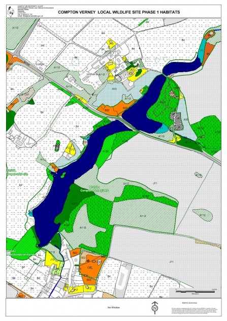
There are now more than 660 Local Wildlife Sites, which cover an area of over 7,800 hectares across Warwickshire, Coventry and Solihull. You can see an interactive map showing the data gathered here.
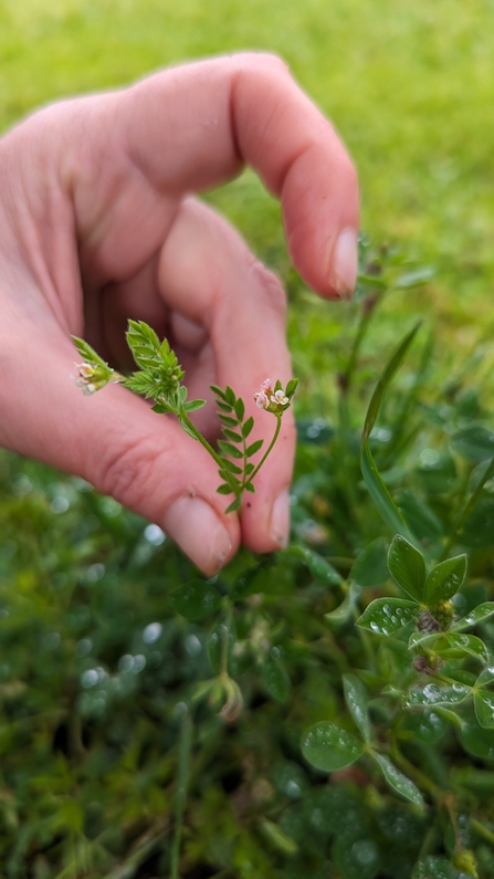
Warwickshire has a huge diversity of plants including Bird's-foot (Ornithopus perpusillus) - April Webb

By April Webb - Even brownfield sites can bring up some surprises like bee orchids

Busy surveying! - April Webb
Satellite Data
In July 2023, NCAP acquired some exciting new satellite data from an external company called Spottitt. This will be an incredibly useful tool when it comes to assessing habitat data at a landscape-level, alongside our existing datasets.
Satellite data is hugely valuable for so many reasons. It can provide useful information for areas that aren’t accessible on the ground. It can also allow us to view habitats from a different perspective. In dense woodland for example, it would be difficult to identify the tallest trees from the ground, but we can easily and rapidly use remotely sensed data to do this instead.
Using a combination of satellite imagery, remotely sensed height data and a vegetation index that picks up on the health or density of vegetation, Spottitt produced a ‘classification map’. On this map, the entire Warwickshire, Coventry and Solihull region is categorised into one of 11 habitats, including woodland, water and grassland.
Checks are needed to see how well each habitat on the ground has been allocated the correct habitat in the map. Once this has been done, we will be able to start answering lots of different questions. For example, we can use the data to see whether any potential Local Wildlife Sites have been developed on. We could also use it to identify gaps in connectivity between habitats that need filling so that wildlife can continue to move between them.
Future Work
Going forward, all these data layers will be enormously valuable when it comes to monitoring how habitats are changing over time and will better inform conservation action at a landscape-level. It will help us to assess for example, whether Warwickshire Wildlife Trust is meeting its strategic aim of 30% land protected, recovering, or connected for nature by 2030. Without data, we wouldn’t be able to monitor progress toward our conservation goals.
An example of a Phase 1 habitat map